My Radar Pictures!!
Pics from 4/2/99 and 4/21/99 And 4-26-99
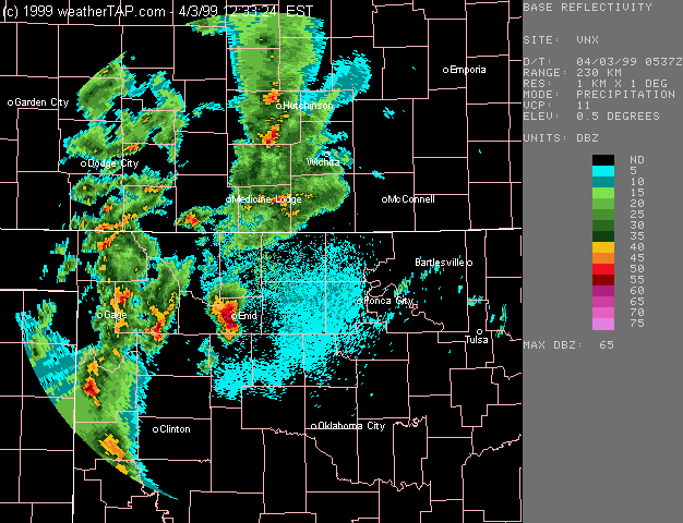
This Radar image was saved on 4/2/99 around 10:30pm,this cell that you see getting ready to hit Enid put down golfball sized hail and also a couple tornado warnings,It also produced 70mph winds.
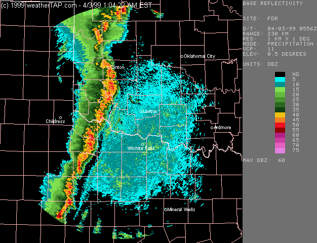
This Radar image was also saved on 4/2/99,this shows a very intense squall line,The line also had a few possible tornadoes embedded in the line though none were confirmed,The line also produced 80mph winds and better.
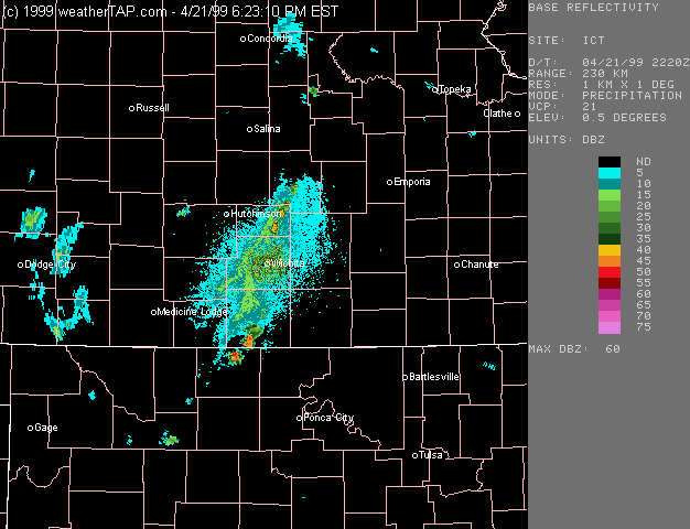
This radar loop shows the blow up of storms along the dryline on 4/21/99,this line produced 3-4 confirmed reports of tornadoes on the ground,it also produced baseball sized hail,And near 7 inches of rain near Enid(notice it doesnt move any it trains)

A loop of 4/26/99 A supercell with a tornado reported on the ground at this time,also notice the storm suck up the other storm making it even more intense.